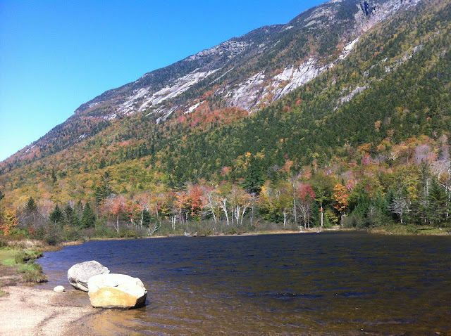
2011- Fall Aflame in the Whites- Avalon, Bridal Veil Falls and Sugarloaf (with a surprise or 2 at the end)!!
Coppermine trail to Bridal Veil Falls...What a lovely hike from behind Pinestead Farm and starting up the western flank of Cannon Mountain in New Hampshire. This was the perfect start to a few days of getting back in shape after our difficult past Summer.....our dear, sweet Mom would be proud to see us getting back outdoors and enjoying Nature.
After weeks of hearing about the damage that Hurricane Irene had inflicted on this special part of the Whites, it was time for us to see it for ourselves. The drive over to the Highland Center at the top of Crawford Notch was spectacular with the above stunning view of Mt Washington brooding over Bretton Woods. The AMC website had kept us all updated....the #302 through Crawford Notch to Bartlett and Kankamagus Highway from Bear Notch Road to Woodstock had been closed for 3-4 weeks due to road and bridge wash-outs. Below is a picture of Sawyer River bridge wash out which is now replaced with a temporary steel structure.....and the video shows how the river undercut the banks of Sawyer River.
Time for a challenging hike to clear the cobwebs....starting from the Crawford Depot we head up Avalon Trail going round-trip 6 kms. with a 1500 feet elevation gain. Stream crossings were still a challenge with water high, the usual rocks and logs being washed away. Let's stop and make a new crossing, flinging rocks into the fast-flowing water with great abandon. Wait, our young friend stops to help on the way to Zealand Hut! Robert and I became great supervisors....!! Thank you, trail angel!!
Then, he very nicely helped us across....chivalry is NOT dead!! By the way, when we returned most of these rocks were washed away and our boots were so soaked we just strode right through the water!
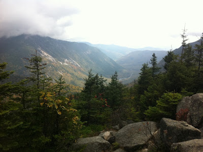
Onward, upward, passing quite a few groups and solo hikers. One group said "Don't bother, nothing to see!" as the mist was closing in. We barreled up the Avalon Trail, scrambling quite a bit over huge rocks, then took a sharp left turn off to the summit of Avalon, with the trail straight ahead leading to Mt Field another 1000 feet up. What do we have here but blue sky looking down a fabulous view of Crawford Notch and Webster Cliff! Yes!! But wait, looking back down to the Highland Center we see our car 1500 feet below as well as a HUGE, low, black cloud-bank rolling in from the west. Ah well, time to sit and have a munch and drink and think....
What is this we see? Styrofoam? Not a chance....it was the start of a HUGE hailstorm! In contrast to the above idyllic "before picture", check the below picture of Crawford Notch absolutely blackened out a mere few minutes later, actually a spectacular view. No time to waste.....we are "outta here" as freezing rain might be next. This is the real lesson for hiking the Whites....the weather can change this dramatically and dangerously. Always keep those 10 essentials for survival in your pack, eh?! Can you name them? See www.outdoors.org
Happy ending to the story as we steadily and swiftly descended to the Depot below in quite a white-out of hail, with the white stuff staying on the trail for 500 feet of elevation. Great adventure!
Don't I look calm as I stroll along this red-leafed wonderland near the trail's end? Bright and sunny.....not a worry in the world!
Day 3 we decided to do a shorter hike, with a 360 degree view as our reward. We calculated that from the top of Middle Sugarloaf (off the Zealand Road trailhead) we were able to see close to 25 miles of the Appalachian Trail..... from Mt. Layfayette along to Mt Garfield and Gale, then over Zealand Cliff to Webster Cliff and then the whole length of the Presidential Range. WOW!! Here you see beyond us Mt Washington and the other majestic peaks of the Presies!
and a great ladder to the granite outcrop that the AMC has thoughtfully installed.
Yes, that is Robert perched at the top, glowing in the sunlight!
Are we eager to go back? You bet...and we're planning to hike this favorite on our way back to NH next Spring. Can you guess its name?
Now back on beautiful PEI all aflame as well.....and yes, there are some great trails here as well! Last week found us on the Dromore Woodland hike....7 kms. around a lovely loop trail.
More hikes to come....maybe in Barbados!!


0 Comments:
Post a Comment
<< Home