2015- West Highland Way- Magical Scotland keeps bringing me back

Milngavie (easy access from Glasgow by bus or train) to Dryman-.
easy, rolling walk through small towns north of Milngavie


Approaching Dryman.....pink girls and flowers

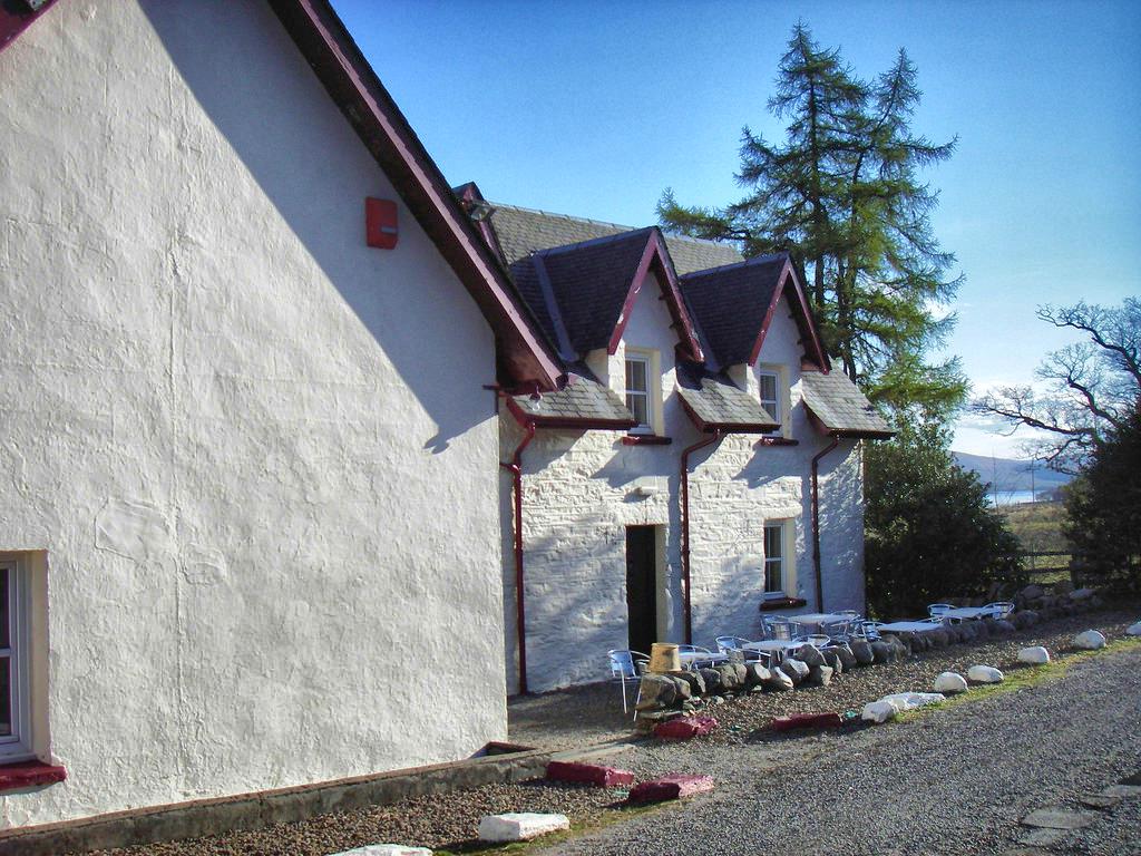
Kip in the Kirk hostel in Dryman, a converted church, complete with breakfast- such a warm welcome! Frances the hostess excellent and very welcoming


3 private ensuite rooms on main floor
Excellent breakfast
Buy food at Spar grocery store nearby, could cook up dinner at hostel. Bought food for next few days.
Buy food at Spar grocery store nearby, could cook up dinner at hostel. Bought food for next few days.
Clachan Inn 5 minutes away from hostel, great gathering place and good pub food..."oldest licensed pub in Scotland"....;-)
 I'm in heaven!!
Stage 2- 22 kms.- Dryman to Rowardennan
A wild storm hit us on our climb over Conic Hill....blew a few hikers over and 2 quit the WHW with injuries. Amazing view over Loch Lomond and the great fault line seen in the line of islands. This is the division between the upper and lower highlands of Scotland with Conic Hill being part of the fault. The closest Island is Inchailloch where many of the McGregor chiefs are buried. We visited this island 2 years ago....my ancestral home!


 Balhama (half way point)- cafè nice after tough climb over Conic Hill,

Here I am with a 1600's tomb covering on the island we visited in 2013.
Good food shop right beside cafe...get stuff for long haul along Loch Lomond
Rowardennan Hostel with above view southwards along Loch Lomond from lounge
-located 1 km past hotel at base of Ben Lomond
Hostel is (22£) for bunk, full linens, different prices for different number of bunks in a room
Meals offered (hostel bunk, dinner and breakfast was 37£)
Available tenting (cost?)
"Wild" camping is allowed north of this hostel on WHW
Stage 3- 20 kms. to Inveroran- tough stage, many people said it is the toughest stage...true but absolutely gorgeous views of Loch Lomond all day

Halfway at 11 kms.- Inversnaid- hotel pricey
Hostel behind, good destination to break up this very tough and long Stage 3
We bypassed and headed to Inveroran
You could take a water taxi across the loch from the highway on the west side....and start here.
You could take a water taxi across the loch from the highway on the west side....and start here.
What a 3rd day!
Bonnie, Bonnie Loch Lomond shores. Bog, mud, roots and rocks...sound familiar? Thank goodness for my White Mountain experience.... BUT spectacular views along the waterside with weather starting to clear out.


Runoff from mountains above us was gushing and musical....
 Stopped for lunch and enjoyed best views of all...


Old homestead ruins along the loch, with cleared out fields where animals grazed.
 Water was dangerously high at this crossing near Inversnaid Hotel. Sign posts at upper right shows the cutoff for Loch Katrine and where Rob Roy Mcgregor fled when chased down by his enemies.
 Rob Roy hid in the cave system found in a jumble of rocks beside Loch Lomond. Could this have been where he was once, in the 1740's?!


 And looking south along Loch Lomond....for one last look at this magical, mythic place in Scotland.
 Glorious beauty here...and the pub gatherings at the end of the day just fantastic sharing of stories. Enjoying local brews and fish and chips, etc. Last night was special.... Looking forward to more stories at the pub each night!
Runoff from mountains above us was gushing and musical....
Old homestead ruins along the loch, with cleared out fields where animals grazed.
Now at the most northern point of Loch Lomond....
Sitting right next to us a father-son walking duo from Charlottetown, PEI... Amazing small world.
Inveroran- Beinglas Farm- great social pub, small food and camp gear shop, excellent B&B (8 units at 50€, full breakfast) , tenting area
Drover's Inn about a 15 minute walk away- don't know any details
Now have 3 days of sun coming up ....many Blessings to all of us!
Total of 66 kms of the 160 kms....hiking partner Penny a wonderful support.
 Stage 4- 18 kms to Tyndrum

Tyndrum- "By the Way" hostel (18£)- very economical with a great kitchen with 2 sink areas, 2 large fridges and 4 cooktops
-full set of linens, 4 people to a room in 2 bunk beds. I lucked into a "private" room....no one else there!
-Large groups of Trekkers stay here for several days of nearby mountain hiking and cook up their meals each night
- tenting for 2 and 4-person tents and picnic tables for cooking up, will rent out sleeping bags with sheet liner.
-excellent food and goods shop a 5 minute walk away, (The Green Welly), good pub, pricey restaurants
*****No food shops in Bridge of Orchy, get groceries in Tyndrum

 Penny enjoying the look of this large tree....
 Overlooking Crianlarich below....nice picnic table at the top of this uphill.

Above, video from this viewpoint. Below, crossing the River Fillan....
 Interesting priory from the 13 century....St Fillan from Ireland whose mother is buried at Inchlaichoch Island, near the McGregor chieftains.


 Glorious sunny day as we climbed up from Loch Lomond into the Highlands. Scenery changing constantly as we followed River Fillan then past Ben More into the Caledonian forests. Steady uphill to a great overlook of Crianlarich, a few blasts of snow and hail, then back to sunshine.
*****No food shops in Bridge of Orchy, get groceries in Tyndrum
Overlooking Crianlarich below....nice picnic table at the top of this uphill. Above, video from this viewpoint. Below, crossing the River Fillan....


Had my first encounter with a BOG...sank in about TWO feet before I pulled the leg out. It was my "bad leg" with problem Achilles' tendon....seems fine but it was a bad scare. Lesson learned...stay on trail and poke around with my hiking pole to find hidden rocks!! I will be leaving this pair of hiking boots in Scotland...full of peat bog and mud with cow manure and sheep "sh-t"... Eeeeyew....

 Halfway done today...86 kms total. I bought a little book today of 40 best walks in Loch Lomond and the Trossachs. Also looking at the Rob Roy walk... Should keep me busy for a few years! I keep looking for a little Scottish village which I could use as a home base for a few weeks.
Stage 5- 12 kms. Tyndrum to Bridge of Orchy
Bridge of Orchy- bottleneck area , BOOK EARLY
If you can get into Inveroran Hotel 5 kms up track best alternative. Usually booked very early in season ( I tried in January for May, all booked)
Cuts off 5 kms. for next stage.
Otherwise, you have 4 options in Bridge of Orchy
Sleeper train car-avoid- kitchen a pigsty, shower dirty, 9 to room , in 3 bunks
Hostel-type accommodations behind hotel
Bridge of Orchy Hotel- expensive, staff not very friendly, touristy
Stance Cottage B&B where I stayed - 75£- very good all-round (but $$$), excellent breakfast and packed lunch lasted 2 days- located right beside hotel


A little history of the military roads which the WHW follows....

The mountains of Glencoe are snow-capped....way beyond! What a view of our WHW hiking path.


On to the Rannoch Moor section of this stage. We were blessed with great weather....avoid this when bad weather is threatening. Very dangerous and exposed.


Stopped here for lunch....simply glorious views. 


Looking closely at the below picture you can see the foundations of an old farm....

View of Rannoch Moor, looking north-east....lots of bog, marsh and water. You can see the highway cutting across the moor. Don't wander here!

Rounding the shoulder of Glencoe mountains the upper part of Glencoe Pass comes into view....breath-taking!


 Kingshouse Hotel is located to the right of the above picture, tucked away at the base of the mountain ridge. It has now been demolished and a new structure stands here....what a shame!

Our hiking group starting from around Day 2...happy to enjoy a brew and a tasty meal. There is a hostel in the back of Kingshouse which has a funky pub and bar.

Stage 6- 20 kms. Bridge of Orchy to Kingshouse Hotel in Glencoe Pass-
 BOOK EARLY
Kingshouse has both a hostel and a hotel, not a village, no groceries, quite isolated- lovely atmosphere in hotel, several dining areas, friendly pub
I ended up the ski mountain at the Glencoe Mountain Resort in a micro-lodging (fondly know as a hobbit house) NEED A SLEEPING BAG!


 50€ for a 4 person shelter, has heater and kettle. Could cook up basic meals, I had porridge and coffee. You could cook up dinner using hot water and watch the sunset over Glencoe Pass...quite magical
Many camper vans for electric and water with picnic tables and fire pits.
Another area free for campers with no electric and water.
Tenting areas with full services near by.
Segregated showers and toilets at main building . 1£ for 5 minutes of hot water. Open 24 hours.
Main drawback- main building with bar and food closes at 9:00 pm and only opens at 9:00am so difficult if pouring rain, etc.
Bring your own food!


Many accommodations in Kinlochleven.
Black Water Hostel seemed to be ok from what I heard and had hobbit houses (40£ for 2 people and 50£ for 4 people)
I stayed at Trailrace Inn which became the gathering place for a good pub social life- bar, food. Nice view from my room...
 Great fun as people dropped by before heading to their different accommodations- hostel, hobbit house, other inns
Actually, all along the Way the outstanding dish was haddock (fish 'n' chips) beautifully cooked.
Actually, all along the Way the outstanding dish was haddock (fish 'n' chips) beautifully cooked.
Stage 8- Kinlochleven to Fort William- 24 kms.
Straight up climb from Kinlochleven which you can see behind us, then long stretches along valleys between 2 mountain ridges.
 We hit a thunderstorm....scary.
Today the elements threw everything at us. Howling gales and buckets of water as we climbed over 2 mountain ridges. Then a HUGE thunderstorm....and of course we were right on the 2nd mountain ridge. Cracks of thunder and flashes of lightning, then pea-sized hail pelted us for 5 minutes. Did NOT take pictures....:-0 Came to a neat sign about Macbeth, King of the Scots (1040-1057)
 Below, you can see the farm beyond....
 Halfway on this stage, you have a choice of 2 routes: we took the longer one towards Ben Nevis and the Glen Nevis route. Beautiful especially when we walked through forest.
Walked out of the mountains, trails awash in water, then north to the Ben Nevis area. Had a lunch break with the sun warming us and the top of Ben Nevis cleared out beautifully.
Walking north, Ben Nevis is totally obscured by cloud....


 Then the cloud starts to clear....what a monstrous mountain.

 As we walked down Glen Nevis the clearing was complete....you can see the trail up Ben Nevis from the glen in the cleft to the left.

 The ruins of an ancient fort facing Ben Nevis were on a side path....and Robin met us about 5 kms. from Fort William, nice to see his welcoming smiling face!

 Clouds roll in and a rainbow arches over the Ben Nevis hostel below....we stayed here last year.
 What a final day for the West Highland Way....24 kms for a total of 159.4 kms from Milngavie to Fort William.
Walks into Fort William, and right to the end....greeted by the statue of sore feet.

 Everyone showed up at the pub...last picture shows a small part of our group from the last 8 days.

 Many accommodations in Fort William.
Today the elements threw everything at us. Howling gales and buckets of water as we climbed over 2 mountain ridges. Then a HUGE thunderstorm....and of course we were right on the 2nd mountain ridge. Cracks of thunder and flashes of lightning, then pea-sized hail pelted us for 5 minutes. Did NOT take pictures....:-0 Came to a neat sign about Macbeth, King of the Scots (1040-1057)
Walked out of the mountains, trails awash in water, then north to the Ben Nevis area. Had a lunch break with the sun warming us and the top of Ben Nevis cleared out beautifully.
Walking north, Ben Nevis is totally obscured by cloud....

Walks into Fort William, and right to the end....greeted by the statue of sore feet.
Boots are DONE....bequeathed to a friendly taxi driver with a note how they have traversed the Camino, parts of the AT, alot of southern Spain, Gaspesie, PEI, Ha!


posted by Sue/Robert @ 4:16 PM
0 comments
![]()

